Monday, July 4, 2016

DFW BIM Infrastructure User Group Class Agenda

Good afternoon everyone. I am definitely excited about the DFWBIUG training event. This has been three months in the making. It basically became a second job for me trying to find the perfect location, working with all the instructors schedules, and getting sponsors for the event. Now we are just two weeks away. Some of the registered attendees have requested to see a class agenda. As requested, I have posted the preliminary class agenda for each classrooms. In addition to attending classes, attendees will have the opportunity to network and learning about our sponsors software and products, in the exhibit area. We will have roughly 6-8 sponsor/vendor booths. A light lunch will also be provided. After the event, I would like to go to Champs for happy hour. Anyways, I hope to see everyone there. Definitely a great group of instructors for this event.  I also posted the class floorplans below.

Classroom Layout

DFWBIUG Training Day 2016 Agenda

Friday, July 15, 2016

7:30 am to 8:00 am

Exhibit Area Open / Breakfast Snacks

CLASSROOM G1

8:00 am to 9:00 am

InfraWorks 360-The Dynamic Dou: Get More Done with InfraWorks 360 and Civil 3D Together

9:00 am – 10:00 am

Infrastructure Design Suite Data Exchange

10:00 am to 10:15 am

Break

10:15 am to 11:15 am

Why InfraWorks 360

11:20 am to 12:15 pm

Customizing Autodesk InfraWorks 360

12:15 pm to 1:25 pm

Lunch

1:25 pm to 2:25 pm

2:30 pm to 3:25 pm

Terrain Extraction from Reality Capture Point Cloud Data

Open

3:30 pm to 4:30 pm

City Asset Feature Extraction from Reality Capture Point Cloud Data

4:35 pm to 5:30 pm

InfraWorks 360 Open Forum (Panel: Todd, Brian, Ramesh, Tony,)

CLASSROM G2

8:00 am to 9:00 am

A Practical Guide to GIS in AutoCAD Civil 3D

9:00 am to10:00 am

Civil 3D Style and Settings Tips and Tricks

10:00 am to 10:15 am

Break

10:15 am to 11:30 am

Pressure Pipes in Civil 3D – Gravity and Pressure

11:30 am to 12:15 pm

Open Class Discussion

12:15 pm to 1:25 pm

Lunch

1:25 pm to 2:25 pm

Reality Capture with Leica Cyclone

2:30 pm to 3:25 pm

A Practical Guide to GIS in AutoCAD Civil 3D

3:30 pm to 4:30 pm

Storm & Sanitary Analysis – From Rainfall to Runoff to Discharge

4:35 pm to 5:30 pm

Open

CLASSROM G3

8:00 am to 9:00 am

Car Animation in InfraWorks 360

9:00 am to 10:00 am

Working with Profile Structure Styles in AutoCAD Civil 3D

10:00 am to 10:15 am

Break

10:15 am to 11:30 am

Working with Storm Culverts in InfraWorks 360

11:30 am to 12:15 pm

InfraWorks 360 – There’s a Trick to That

12:15 pm to 1:25 pm

Lunch

1:25 pm to 2:25 pm

Creating Hydraulic Pipe Labels in AutoCAD Civil 3D

2:30 pm to 3:25 pm

Open

3:30 pm to 4:30 pm

InfraWorks 360 and Civil 3D Interoperability

4:35 pm to 5:30 pm

Car Animation in InfraWorks 360

CLASSROM G6

8:00 am to 9:00 am

Follow the GIS Brick Road: Civil 3D/MAP 3D

9:00 am to 10:00 am

Working with Autodesk Vehicle Tracking Design Tools

10:00 am to 10:15 am

Break

10:15 am to 11:30 am

3rd Party Apps in AutoCAD Civil 3D

11:30 am to 12:15 pm

InfraWorks 360 – There’s a Trick to That

12:15 pm to 1:25 pm

Lunch

1:25 pm to 2:25 pm

Advance Grading Tips in AutoCAD Civil 3D

2:30 pm to 3:25 pm

Open

3:30 pm to 4:30 pm

Pond Grading and Analysis Made Simple

4:35 pm to 5:30 pm

AutoCAD Civil 3D Open Topic Forum (Panel: Eddie, Rick, Juan, Jason)

CLASSROM G7

8:00 am to 9:00 am

Revit Tips and Tricks Basics

9:00 am to 10:00 am

Working with Revit Part Families

10:00 am to 10:15 am

Break

10:15 am to 11:30 am

Demystifying Revit’s Stairs and Railing

11:30 am to 12:15 pm

Revit Open Forum Discussion

12:15 pm to 1:25 pm

Lunch

1:25 pm to 2:25 pm

What’s New in AutoCAD Civil 3D 2017

2:30 pm to 3:25 pm

Revit Interference Checking vs Navisworks Clash Detection (AIA 1 LU)

3:30 pm to 4:30 pm

Concept Design for Commercial Development Workflow -InfraWorks 360 to Civil 3D to Vehicle Tracking

4:35 pm to 5:30 pm

New Features & Workflows of Autodesk Building Design Suite 2017

CLASSROM G8

8:00 am to 9:00 am

3rd Party Apps in AutoCAD Civil 3D

9:00 am to 10:00 am

Reality Capture with Leica Cyclone

10:00 am to 10:15 am

Break

10:15 am to 11:30 am

Introduction to Panzura

11:30 am to 12:15 pm

AutoCAD Tips & Tricks 2016-2017

12:15 pm to 1:25 pm

Lunch

1:25 pm to 2:25 pm

What’s New in AutoCAD 2017

2:30 pm to 3:25 pm

Open

3:30 pm to 4:30 pm

Introduction to Panzura

4:35 pm to 5:30 pm

Revit Open Topic Forum (Panel: Kevin, Gabe, Daniel)


Eventbrite Post: https://www.eventbrite.com/e/dfwbiug-training-day-2016-tickets-25422176414

Thursday, February 4, 2016

Winning Work with InfraWorks 360

Here is a recent post I made on our company blog.

Engineering design workflows have evolved during the past 50 years from manual hand drafting on paper, to overlaying scanned GIS maps, to now creating rich compelling 3D rendered models with InfraWorks 360. With InfraWorks 360, design professionals can seamlessly create multiple conceptual design proposals to help evaluate decisions and increase the approval process with clients/developers and city review agencies. 

A few months ago one of our clients came to us with a vision to create a 16 building multi-use project in San Antonio. With only a very basic overall schematic site exhibit, our task was to bring the client's vision to life. Yes, we could have done the norm, by creating a 2D conceptual site plan with maybe a simple Google Sketchup exhibit or PowerPoint slide but we wanted to add a little more realism to the site project and incorporate a BIM workflow. To truly bring realism and tell a story of what the client was proposing to build and enhance the community environment, we created a preliminary concept site model with InfraWorks 360.


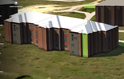
With InfraWorks 360, we were able to quickly insert 16 buildings with different footprints, heights and facades. In addition, landscape features such as bushes and trees were also included. Pavement markings. people, and city furniture such as light poles, street signs, trash cans were also added to provide the look, feel and real environment to the model. To add more realism to the 3D model, animated background clouds, and real world sun light environment was created to produce real shadow casting throughout the site model. We were able to view quickly and easily how shadow casting would affect the site during the morning and late afternoon hours. 


Once the model was completed, screen shots from varies angles were created. In addition, a video fly-by was also created, to be used during the client presentation. On top of that, the during the client meeting, we used the InfraWorks 360 3D model in a live environment by manually navigating throughout the site model per the clients request. With InfraWorks 360, we were able to quickly and easily make site revisions on the spot.

With the power of InfraWorks 360, we were able to create a rich compelling visual 3D model in one day and collaborate live with our clients and help them achieve their project vision. With the tools in InfraWorks 360, we were able to win the project and proceed with the project. 

Sunday, August 9, 2015

Autodesk Software Updates, Troubleshooting and Events

Good evening everyone. I have posted links below for this months important software updates and troubleshooting fixes for Infrastructure Design Suite Premium software. In addition, I have also provided links to important webcast and events for this month. Please continue emailing support questions to me. I have begun updates old post with missing images. If you need a blog post updated, please feel free to email me and I will move it to the top of my list to-do. Starting this week I will begin posting tips and tricks for InfraWorks 360, A360 and Vehicle Tracking also. Thank you for visiting my blog. Have a great week.

Software Updates
AutoCAD Civil 3D 2016  Service Pack 1
AutoCAD 2016 Hotfix 2
AutoCAD Civil 3D 2016 Object Enabler
Autodesk 3ds Max - Civil 3D 2016 Object Enabler
AutoCAD 2016 DWG to PDF Custom Properties Hotfix
Autodesk Revit 2016 Service Pack 2
Autodesk A360 Collaboration for Revit 2016
Autodesk Vault Data Standard Update 2 for Vault 2016 Workgroup and Professional

Troubleshooting
InfraWorks 360 - Bridge Refuses To Go Over Another Road
InfraWorks 360 - Imported FBX File Geometry is Degraded
AutoCAD 2016 - File Check-In into Autodesk Vault
AutoCAD 2016 - Unable to Change Lineweight of Line
AutoCAD Civil 3D 2016 - Lineweights Do Not Plot Or Publish Correctly from AutoCAD
Civil 3D 2016 - Suppress the Initial Revision Table Row From Autodesk Vault - Inventor
Civil 3D 2016 - Microsoft Internet Explorer 11 and Preview Issue
Civil 3D 2016 - Importing or Opening IFC files
Civil 3D 2016 - Wheel Mouse Does not Perform Zoom Functions
Civil 3D 2016 - Repair a Corrupted Drawing Using Map Query
Civil 3D 2016 - Unable to Export MicroStation DGN Files
Civil 3D 2016 - Cannot See Model and Layout Tabs in AutoCAD
Civil 3D 2016 - Error: "INTERNAL ERROR: UNDOCMD3" when saving in AutoCAD
Civil 3D 2016 - Cannot Mapping Autodesk AutoCAD Block Attributes with Properties in Autodesk Vault
Civil 3D 2016 - Incorrect Corridor Boundary From Extents as Outer Boundary
Civil 3D 2016 - GALLERYVIEW Variable Has no Effect on Text Style Thumbnails
Autodesk 3DS Max - Only 50% CPU Usage When Doing a 3ds Max Backburner Rendering on Server System
Autodesk 3DS Max - 3DS Max 2016 Setup Doesn't Install

Free Webcast
Autodesk - Scripting for InfraWorks 360
CADD Microsystems - Autodesk Account, Subscription Benefits, A360 Overview
PacifiCAD - Bridge Design for InfraWorks 360
CAD Technology Center - AutoCAD Dynamic Blocks Part II
Autodesk - Building Blocks (Revisited)
Autodesk - Attributes! Making The Most of Your Data
CAD-1 Inc. - Civil Chat
CAD Technology - Civil 3D Pipe Network Annotation - Tips & Tricks
PacifiCAD - Civil 3D Plan & Profiles Production
Synergis Technologies - Visualize, Collaboration, an Validate with Autodesk IDS

Events in DFW
DFWBIUG - DFW BIM Infrastructure User Group Meeting

TIP OF THE DAY
When working in InfraWorks 360, and you want to apply different façade styles to each building face you must set the Building Façade Detail Setting to Medium or High. This is done within the Application Options.The Application Options can be found in the Setting & Utilities in-canvas tools.


Thursday, September 25, 2014

UPCOMING WEBCAST AND EVENTS

I have finally returned back to posting lol. Sorry I’ve been gone for so long. It’s been a crazy few months for me. I’m with a new firm now as their CAD/BIM Manager. I’m really excited about where this company is headed. Anyways, I thought I would help everyone by share some important events coming up in the next 3 months. On a quick note, I cant believe I hit the 1/2 million view mark on my blog. Thanks everyone. 

Webcast Events:

CadSoft Consulting - Civil 3D for SurveyorsSeptember 25th
MicroCAD Training & Consulting – Infrast. Design Suite - Sept 26th
ATG USA - Working With InfraWorks 360September 30th
Imaginit - Move To BIMSeptember 30th
Pacific CAD - Cloud Services October 3rd
CAD Technology Center–InfraWorks & C3D CollaborationOct. 7th
CADLearning - CADLearning User BasicsOctober 7th
CAD Masters - InfraWorks 360 & Swept Path Analysis – October 8th
Eagle Point - Pinnacle SeriesOctober 8th
Hagerman & Company - BIM for Infrastructure – October 14th.
Ideate - Getting Started With BIMOctober 14th
CAD Technology Center - Civil 3D to 3ds Max DesignOctober 16th
CADSoft Consulting – Transportation Design SeminarOctober 16th
CAD Technology Center - Converting GIS to CADOctober 21st
Ideate - InfraWorks 360October 21st
CAD-1 - Civil ChatOctober 28th
CAD-1 - Why Use AutoCAD Map 3D?October 30th
CAD-1 -Grading With Feature Lines in Civil 3DNovember 20th
CADD Microsystems - Autodesk Infrastructure SolutionsNov. 20th
CADD Microsystems – Civil 3D for Land Desktop UserNov.  20th
CADD Microsystems - Transitioning to Civil 3DNovember 20th
Imaginit - Online Civil User GroupNovember 21st
CAD Microsystems - AutoCAD 2015 Tips & TricksNovember 25th
Ascent - Creating Coverages With InfraWorksDecember 10th

Texas Events

Enceptia - Autodesk Building Design SeminarAustin / Sept. 30th
Total CAD Systems - Latest BIM SolutionHouston / October 30th
Imaginit - Dallas BIM ForumDallas / October 9th-10th
D3 Technology - Cloud TechnologyDallas / December 17th
Civil 3D Fundamentals (3 days)Austin / December 13th-16th

Other Events

Imaginit – UNM BimSmart 2014 SummitAlbuquerque, NM/ Sept. 26h
CADapult Software Solutions - Civil 3D Workshop

AU 2014December 2nd-4th

Thursday, May 8, 2014

AutoCAD Civil 3D 2015 Performance Tips

Good afternoon everyone. I hope everyone is enjoying their week. It’s been crazy at work, at our main office, with remodeling on going. Our main conference room was enlarge because it was unable to handle the large project meetings we were having. In addition, we had several offices get a new paint job, new carpeting and tiles. On top of that, some bldg roof maintenance to fix some leaks. Anyways, I can’t wait till it’s all done.

Well it’s been roughly a month since we first starting using C3D 2015 for production. Though most of the new features in C3D were basically in the AutoCAD platform, overall I was happy with the new version. Our only issue with C3D 2015 is that it’s sluggish at time. Most of us have been experiencing lag time and freezing with 10 mb-60 mb drawing that contain 2-4 xref’s and data shortcuts. On top if that , it’s seems to struggle at time with drawing that contains large amount of hatching such as landscape and hardscape plans.  After spending about a week trying to zone in on the performance problems, and then finding a fix or work around, here is what I have come up with. Hopefully these performance tips will help some of you, that may be experiencing the same issues.

  • Update your video card drive. Don’t go thru the Windows Control Panel, but actually go to the video card company website such as Nvidia.
  • Turn off your graphic performance tool. This can be found in the Options. System Tab. Not once, have I notice any improvement with this feature turned on. Most employees inform me that it works better when its turned off. I also agree.
  • In Options, Selection Tab, Preview section, uncheck all the preview options such as the selection preview and command preview.
  • If you are not using the cloud, log off the Autodesk 360 account.
  • In Options, Plot and Publish Tab, uncheck background Plotting and Publishing
  • Don't have all your tool palettes and dialog boxes always open such having layer manager, properties, sheet set manager, and xref manager. When I am working, I rarely have more then one dialog box open.
  • cleanout or reset your drawing annotation scale list. You don't need 20-50 different annotation scales.
  • In Windows Task Manager end process for WSCommCntr.exe, raysta_3dmax2015_63server, and Aec32bitAppServer57exe (and AcSettingSync.exe if you are not using the cloud)
  • make sure your antivirus software is not scanning your Autodesk programs and drawing files.
  • Last but not least, make your windows paging file larger. If you have 8 gb of memory, then change your windows paging file to at least 16,000 mb up to 24,000 mb. If this is your work computer, I  would ask your IT Dept first, before performing this task.

Anyways, thanks for checking out my website. Have a great weekend everyone. :)

Thursday, March 27, 2014

Hello AutoCAD Civil 2015 Part 1

Good morning everyone. Man it’s been a long while since my last post. Business is booming in Texas, so I have been extremely busy at work. Anyways I would like to provide you a short teaser introduction to the long awaited AutoCAD Civil 3D 2015.  I have listed below some of the key features that has been added to AutoCAD Civil 3D 2015
New Features:
  • New File Tab Dashboard for opening drawings.
  • Integration of Autodesk AutoCAD Civil 3D 2014 Productivity Pack 1, which includes create solids of pipe networks in section views, Autodesk Vault support for pressure pipes networks, and the new Export Civil 3D drawings commands.
  • Advancement to Corridor modeling and features.
  • New design criteria files based on Policy on Geometric Design of Highway and Streets, 6th Add., 2011 published by ASSHTO.
  • Profile advancements such as more options for free vertical curves.
  • Staggered corridor point code labels in section views are now available.
  • Ability to export data to KML and KMZ formats
  • Advancement to Subassembly Composer such as new Offset Geometry tool for adding positive and negative offsets to open or close shapes, input/output parameters for applying superelevations to a subassembly.
  • The new AutoCAD point cloud object provides improved 3D navigation and visual fidelity and support for legacy point cloud file formats  (.ISD files)
  • New Geolocation tools have been added to the contextual ribbon.

2014-03-26_18-33-58

2014-03-26_19-15-53
The file tab dashboard is one of the new addition to Civil 3D interface. For those that use AutoCAD 360 web, it’s somewhat similar to that dashboard. In this dashboard, you can access recent drawings that have been opened.
2014-03-26_18-49-43
The second, eye popping new features is the dark display for the color scheme. As a default C3D 2015 is set to the new Dark color scheme. You can easily change it back to the traditional light theme display in the Display tab of the Options display dialog box.
2014-03-27_7-28-24
The workspace tools and features at the bottom have a new look. You can easily turn off and on features such as quick properties, grid, gizmo, and snap mode  by selecting the last icon the left and checking the features you want on or off. 
2014-03-26_18-51-14
The Autodesk 360 ribbon has a new look with the addition of the AutoCAD 360 Web access tool.
2014-03-26_18-55-31
The Autodesk Recap button has been added to the Insert ribbon. In addition, the ribbon has a slightly new look.
2014-03-26_18-57-00
The Export Civil 3D Drawing tool that was part of the C3d 2014 productivity package is now incorporated into the Output ribbon.
2014-03-26_18-59-10
You can find the Export to KML tool in the Toolspace,  Tool tab.
2014-03-26_19-01-08
The View ribbon has a new look to it.
2014-03-27_7-50-06
Corridor enhancements such as frequency settings along curves can be set by increments, by curvature, or both. This will come in very handy.
2014-03-27_7-57-58
The new Geolocation contextual ribbon has been added once you log into your Autodesk 360 account. I really like this feature. 
Anyways these are just a new features that has been added to the new AutoCAD Civil 3D. I expect the software to be release to the public in 3-5 weeks. Stay tune to part 2 for a more in depth discussion about the new tools and features.

Sunday, December 22, 2013

My Interview With IMAGINiT at AU 2013

Hi everyone. During my trip to AU, I managed to get a video interview with Kevin Breslin from IMAGINiT Technologies. This was actually my first video interview I've ever done, so I was very nervous at the beginning. I want to thank Kevin, Cait, IMAGINiT Technologies and Advantis Comm. for their time and help making this video happen. I had a great time and experience making the video and mingle with the group.

If you don't know who IMAGINiT Technologies is, they are the worlds largest provider of enterprise solutions to the engineering community. They have 40 offices throughout North America and Asia Pacific. They are currently our Autodesk reseller at our firm, providing support, implementation services, data & facility management, consultant services, and training in varies formats.

Anyways, here is my video interview. Enjoy.